|
|
TASCH TO ZERMATT
Click on photos for larger image and then use back button to return to this page
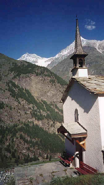
We took the shuttle train down to Täsch and its enormous car park. Leaving the village at 1450m we set off up a steep path up the valley side to the tiny chapel at Täschberg.
|
|
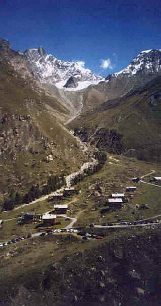
Here we decided to follow the lane up to
Täschalp rather than the path. We were passed several times by the taxi
bus from the station (the recommended way to begin this walk!). After
crossing a dizzyingly high bridge over the Täschbach the road turned
into the hanging valley where the hamlet of Täsch is located. Here is
the Europaweghütte and restaurant at 2187m, being at the halfway point
of the new two-day Europaweg path from Grächen to Zermatt. In summer
2002 part of this walk was closed near Randa due to damage from a
landslide not having been repaired.
|
|
Täschalp
|
|
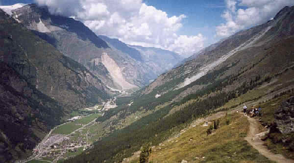
Looking back towards Täschalp with Täsch below down in the valley
The Matterhorn comes into view shortly after leaving
Täschalp and dominates the walk right to the end at Sunegga. Down in
the valley can be seen the enormous amount of work that has gone into
protecting access to Zermatt, in the form of the long avalanche shelters
over the railway. After about 1h 45min we arrived at Tufteren (2215m)
where we had more tea and cake. We decided not to walk down to Zermatt
but continued on to Sunnegga (2288m). Increasingly, on this section, the
mountains beyond the Gornergrat became more obvious: Breithorn, Liskamm,
Castor and Pollux. Finally the cable car to the Untere Rothorn came into
view and down below the valley of the Findelbach. When we reached the
underground funicular station at Sunnegga we took the train down to
Zermatt.