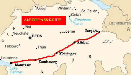
WALKING
THE SWISS ALPINE PASS ROUTE
Kummerley
and Frey- Alpenpassroute (Swiss)
Cicerone
Press – Alpine Pass Route
by Kev Reynolds(UK)
Lonely
Planet- Walking in Switzerland (UK)
|
|
We
used all of these books and found all of use, although the English
language ones give the most detailed account. We photocopied the walks for
each day so we didn’t have to take the heavier guidebooks with us. We
also carried with us the 1:50000 Landeskarte der Schweiz (Offizielle
Wanderkarte der SAW) although we could have dispensed with them as
signposting in Switzerland is unbelievably good. Only once or twice were
we in any doubt over the path to take or the timings. However, having the
maps was useful to identify some of the mountains we passed.
You can now see the Landeskarte maps on the Internet. They are available at various scales for the whole of Switzerland. The map area is only about 3 km square at 1:50,000 but is nevertheless very useful. Click here to another page which will show you how to use it.
Please note: the maps for each section of the route are my sketch maps. They are not to scale and are most definitely not to be used on the walk!!!!
|
|
A sample of the route near Engelberg
It
might seem presumptuous to offer advice about walking the APR but before
we undertook the walk both of us were uncertain of our ability to do so.
Since this might be what you are thinking here is some background to our
walking experience. Hopefully you will be able to judge from this whether
you are up to the walk or need more experience or physical training!
Weather
First
of all the weather conditions vary tremendously in Switzerland. We were
extremely fortunate for the vast majority of the walk. We had one
absolutely appalling day at the beginning (and in hindsight probably
should not have attempted to walk the Foopass in the conditions we did).
Later in the walk we had one extremely humid morning with thunder
threatening- it cleared before we reached any exposed sections, otherwise
we would have turned back. There was one other day when we spent much of
the day putting on and taking off our waterproofs. The rest of the walk
was made on days where the sun shone and temperatures climbed into the
upper twenties- ideal walking weather.
If
the weather had been worse it is possible that we might not have been able
to complete the walk; in early July 2000 heavy snow fell on much of the
route and would have effectively closed the APR to walkers. Fortunately by
August this had all but disappeared at the levels walked.
Experience
Both
of us are in our late forties and have been walking seriously for only
about ten years. We’ve done two long distance walks in the United
Kingdom of about a week’s duration- the Dales Way and a circular walk
around the passes and peaks of the Lake District. However, we have
undertaken frequent multi-day walks from central bases. In Scotland
we’ve climbed almost all the Munros in the Fort William area and some
other Munros and Corbetts in the West Highlands. In Wales we’ve visited
the summits of almost all the high peaks in Northern Snowdonia. In our
favourite area, the Lake District, we’ve climbed the majority of the
peaks over 800m. Our walking has taken us out in all weather conditions,
including quite deep snow, although we’ve no experience of using
crampons or ice axes. I don’t think you should need these on the APR
unless you choose to walk early in the summer. Despite this we were unsure
of our ability to complete the APR. Having now walked the vast majority of
the route it is clear that our “training” helped us enormously.
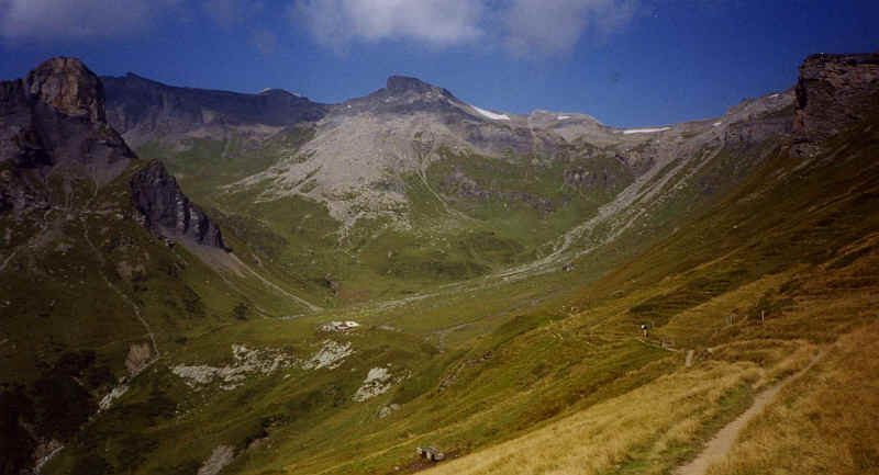
En route to the Rostockhutte, between Murren and Griesalp
What
to carry
What
you choose to take with you in your rucksack will be crucial to your
enjoyment of the walk. We went unsupported by any group back up and had to
carry everything ourselves. I carried a 45 litre rucksack by
Lowe Alpine and Fran carried a 35 litre one by the same make. The
reason for the difference was mainly that my clothes are a little larger
and I like to have spare room in my sack. The total weight of each of our
packs was round about 20lbs.
We
each carried the following, all of which we needed at some stage in the
walk:
Clothing
-
Breathable tee-shirts/shirt/underclothes – 3 sets
-
Spare trousers/jumper/fleece jacket
-
Waterproof over-trousers and jacket
-
Lightweight towel
-
Sun hat and cream
-
Warm hat and gloves
Other
equipment
-
A book to read
-
Plastic box for bread/fruit/tomatoes etc
-
Guide books(each day’s walk photocopied)/maps
-
Timetable details for the escape route bus/train routes we might wish to use. These are obtainable by looking at the SBB’s website on the Internet. (www.SBB.ch)
-
Telescopic walking poles; a pair of these is absolutely essential and most Swiss walkers use them. They will save you from falling, test the ground before walking on it, help you balance, frighten away dogs AND help you walk uphill faster as well as saving your knees on the way down from those high passes.
-
Toiletries/medication/clothes washing liquid/basic first aid kit
-
Two 600 ml SIGG metal water bottles
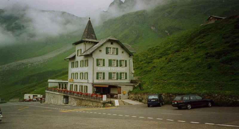
The Klausenpass Hotel
We
booked all our hotels in advance; a little risky if you are absolutely
intent on walking every metre of the route. We took the attitude in Kev
Reynold’s book that the walk was to be enjoyed and not endured.
Therefore, we’d decided that if the weather was too bad, or we felt
unable to tackle a day’s walk then we would simply use public transport
to move on to our next hotel. Thankfully we only had to do this on one
occasion and we still managed a good low level walk even then.
Ruhetag
This
is a German word, which you will become familiar with should you walk the
APR. It means, literally, rest day and can be found outside almost every
hotel, restaurant and most shops on one day a week. Sometimes shops close
for half days in the afternoon once a week. Virtually all shops close on
Saturday afternoon and all day Sunday. As a rule different hotels and
restaurants stagger their Ruhetag so that you should be able to find
somewhere to stay or eat in every village. However, we did run into
problems at Linthal and later at Gsteig with hotel Ruhetags so if you’re
booking accommodation in advance do ask when the hotel has its Ruhetag,
especially if you want to eat at the hotel.
Hotel List
Camping Sites
Several potential A.P.R. walkers have contacted me for information about campsites along the walk. Wild camping in Switzerland is disapproved of so stay in official campsites please.
Please remember that carrying your tent and camping gear over many of the passes will require considerable fitness. It may be the difference between succeeding and failing. Also please remember that the weather in Switzerland can be VERY wet, often for days on end, as well as beautifully sunny. You may prefer the comfort of a hotel room on some nights!
Transport
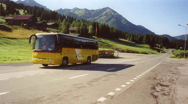
Postbus at La Lecherette near Col des Mosses
The
great thing about the APR is the transport options that are available. At
virtually every stage on the route there are buses, trains or cable cars
that allow you to shorten or omit a stage of the route. We used these to
shorten very long days, as suggested by Kev Reynolds in his book. For
instance the Attinghausen to Engelberg day is long enough without having
to climb out of the Reuss valley so we used the cable car to Brusti.
Similarly between Engelberg and Meiringen we used the cable car up to
Trubsee and down into Meiringen from Reuti. The most boring and unpleasant
section of the route, which involves a lot of road walking from
Unterschachen to Altdorf and Attinghausen, is best shortened by using the
Post bus. It simply isn’t worth walking along miles of busy and largely
urban roads. Use your time more productively in the mountains.
Signposting
is excellent over the entire length of the route. The standard yellow
signs are everywhere. Sometimes they can be a little confusing with
alternative routes to the same place given but the guidebook notes will
help you here. Occasionally there may just be signposts saying Wanderweg
or Bergweg . Usually there will be the white and red flashes of paint on
stones or trees to reassure you that you’re still on the right path.
Route finding, unlike in the British mountains, will rarely be a problem
unless it has snowed heavily.
One
less pleasant side of Swiss walking , especially once you are west of
Kandersteg, is the Swiss farmer’s love affair with barbed wire. It is
used everywhere. Crossing stiles you will have to step over unprotected
barbed wire. Always take your rucksack off when crossing these stiles as
we know, from personal experience, that it is easy to overbalance and hurt
yourself. The farmers also use three strands of barbed wire and three
pieces of wood to make gates with! These require care when opening but you
soon learn how to deal with them.
Another
feature of fencing is the widespread use of nylon tape with metal strips
in to make electrified fences to keep in animals. You can’t always tell
whether they are live or not. The shock won’t harm you but it’s still
not pleasant, so regard all such fences suspiciously. Usually they have a
plastic sprung loaded hook to grasp where they cross the path.
Rest
Days
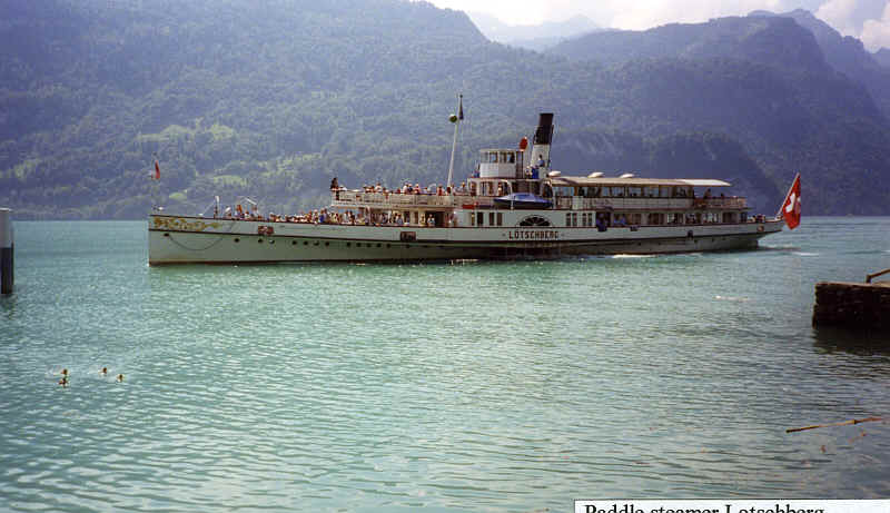
"Lotschberg" paddle steamer on Lake Brienz on one of our "days off"
We programmed into our walk rest days every 3 days or so. The first involved taking the bus from Klausenpass to Fluelen and then a boat trip on the Vierwaldstattersee. On another rest day we took a train to Brienz from Grindelwald and then another boat trip (by paddle steamer). Our third rest day was yet another boat trip on Lake Thun to Spiez after taking the train from Kandersteg to Thun. As you may gather we find boat trips a good way to rest. A mistake we did make was to walk the last five days without a break; although the walks are relatively easy, by this stage in the walk feet are tending to become a little sore or achey.
If
you wish to contact us for any further information my email address is;