|
|
|
VIA ENGIADINA
Stage One:
Zernez
- Susch - Lavin - Guarda - Ardez
Note about maps: These appear above the text for the walk. Where there is a dotted red line this is the route we used rather than the Via Engiadina. All maps are reproduced with the permission of
|
|
|
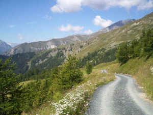
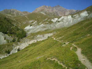
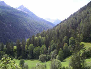
We actually walked this section on the third day of our hike but as it is the first stage of the Lower Engadine section we’ll start our description with this. Basically, it is a valley walk between Zernez and Lavin and is part of both the Via Engiadina and the Unterengadin Talweg (Lower Engadine valley path).

From Zernez railway station we walked through the town and past the church along lanes....

....by the River Inn....

through meadows and along forest tracks to Susch.

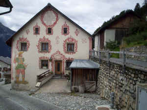
At Susch the road over the Fluela pass to Davos drops into the valley. Above the village are the ruins of a castle, a feature of many locations in the valley.


The church at Susch

Continuing through meadows and forest the track continues to Lavin....

....past the hideous Saglians railway station, where cars are loaded onto trains to go through the Vereina tunnel.

Look back at Saglians

The
track reaches Lavin where the river is crossed to reach the village. The walk from
Zernez to Susch took about 1h 40m plus another hour onto Lavin.
Beyond Lavin we chose to take the easier option of walking to Guarda and Ardez using the alternative lower route. (The more demanding alternative route between Lavin and Guarda can be found at the bottom of this page).

Leaving Lavin we took the lane through the fields which gradually climbs uphill.

We took the higher of the tracks signposted to Guarda (and left the main signposted Via Engiadina route shortly after leaving Lavin.) This route is particularly interesting as it passes through the remains of a medieval village of Gonda.

The farm terraces and house foundations are clearly visible....

.....together with an old
avalanche shelter.

More foundations with Guarda just visible on the right.

Looking back to Lavin

Guarda high above the valley.


Leaving Guarda (1653m) we took the paved lane to Bos-cha ....

Looking back to Guarda from Bos-cha

...... and then climbed higher up the hill on a field track and then a path to reach Chöglias at 1797 m.

Here the main Via Engiadina path was rejoined......

......before dropping down to Ardez (1454) , with its tower, along forest lanes. Including a break in the delightful village of Guarda for coffee the walk from Lavin to Ardez took just three hours.

Near Prui
Passing the chairlift to Ftan
the path climbs through woods to briefly join a lane and then climbs around the
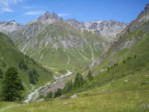
mountain slopes to reach Alp Laret farm and restaurant at 2202m. The path then gradually
drops down the side of Val Tasna before falling steeply down to Alp Valmala at
1980m. Here there are superb views of the Dreilander Spitze (3197m) and its
glaciers. The time from Motta Naluns to Alp Valmala was 2h 30m.
Alp Valmala
We headed off down the broad track but decided to stay on the forest track by the river, rather than take the Via Engiadina path at Alp Tasna. The track crossed over the remains of a landslide which required careful footwork! After briefly joining a paved road the path to Ardez climbed past the ruins of an old tavern at Chanoua and then gradually dropped down to Ardez.
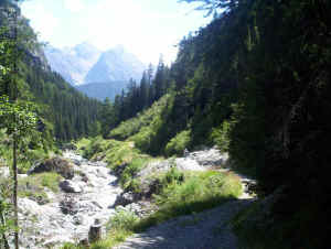
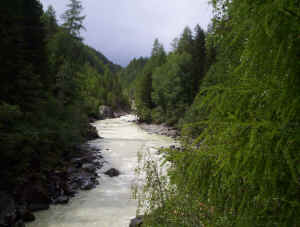
By the river between Alp Tasna and Ardez

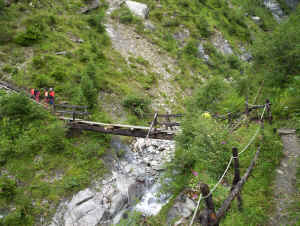
Descending to the bridge over the Inn
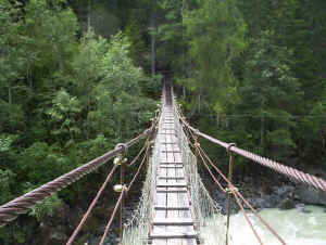
The bridge - not as bad as it looks!
It can't be that bad as Stephen took a photo from the middle of the bridge
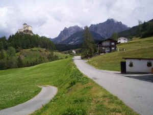
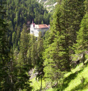
Schloss Tarasp
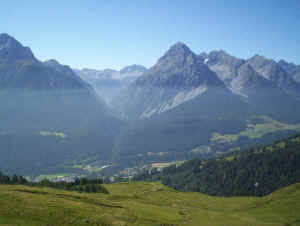
Stage Three – Motta Naluns - Sent - Vna

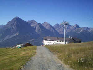
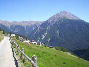
Motta Naluns with the mountains on the south side of the Inn valley
This was actually the first section of the Via Engiadina that we walked on
but it fits in logically here. Taking the gondola cable car from near Scuol
railway station we began the walk at Motta Naluns at 2142m. The broad track
leads up into the ski area as far as point 2323m where a path then drops down to
the farm at Jonvrai (2179m). Signposting in this area is confusing (and
sometimes non-existent) and a sharp
right turn is needed, just before the farm, onto a path that runs down the side of a
stream to a footbridge and then climbs back up onto the mountainside.
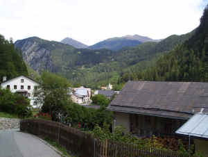
Scuol down in the valley
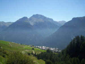
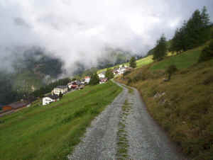
The village of Sent

After
a break in Sent we retraced our steps to the outskirts of the village to rejoin
the route. This runs on farm tracks, above the road to the Val Sinestra, for about
2km before joining this unpaved road. Despite being unpaved this carries a regular post
bus service to the Kurhaus Sinestra hotel, as well as cars. Luckily it wasn’t
too busy but, being unpaved, was rather dusty when vehicles passed by. The road
passes through the woods high above the river with some spectacular views down
into the valley.
On the unpaved road to Val Sinestra
Kurhaus Sinestra
Once out of the wood the path
meets a broad farm track which is followed more or less on the level to Vna at
1602m. Our time from Sent to Vna was about 2h 30m making the Motta Naluns to Vna
sections a pleasant days walk of about 5h 30m.
The village of Vna
Stage Four - Vna - Tschlin - Martina

The final section of the
Via Engiadina to the border at Vinadi is the most demanding part of the Via
Engiadina. In
fact the “official” guide suggests that it should only be walked from Vinadi
to Tschlin because of the steepness of the path and its exposed nature above the
near sheer walls of the Inn gorge. As mentioned earlier we had decided that we
weren’t going to attempt this section.
We were determined,
however, to walk to the Swiss/ Austrian border and, fortunately, the border runs
along the Inn at Martina and there is a frontier crossing point in the village.
Our plan was simple; we’d walk from Vna to Tschlin and either walk down to
Martina, or catch the Post bus down to Strada and walk the along the valley path
to Martina.
Leaving Vna
So we caught the bus up to Vna and walked to
Tschlin. The signposts
suggested times between 2h 15m and 2h 30m but we took a straight 2h. Leaving Vna
(1602m), on a rather cloudy morning, we headed up the lane to Chamlsura (1703m)
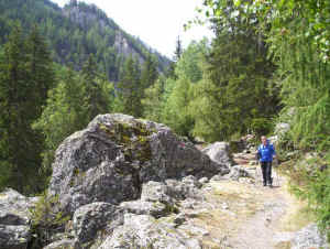
and then on a variety of forest tracks, paths and field tracks to Chilcheras.
Here the Via Engiadina suddenly drops very steeply into the Val Ruinains to a
bridge over a stream. To our dismay three rather unfriendly workers were
rebuilding the footbridge and there were no handrails on it; it felt a little
bit like walking on a tightrope above the stream 20 feet below! The path then
climbed out of the valley and then slowly dropped down through fields to Tschlin.
Footbridge under repair......
Tschlin
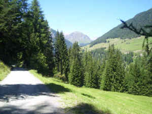
After a break we caught the Postbus down to Strada to save putting Fran’s feet under any more pressure than necessary. To walk down to Martina takes about 1h 30m. A paved lane was taken out of Strada signposted for Chaltur and Martina. This turned into a forest track which gradually descended towards Martina. The time needed was just over an hour.
Between Strada and Martina
Martina
This completed the Lower Engadine section of the walk so we now moved our base to Samedan to tackle the Upper Engadine part. Click here to go to the next page.
Alternative more demanding sections of the Via Engiadina


http://www3.scuol.ch/de/navpage-SummerSCUOL-HikeSCUOL-107705.html
and to down load the pdf. file of the maps click here
